
‘Experience Adventure Beneath the Stars and Himalayan Majesty’

Sar Pass Trek: An Adventure of a Lifetime
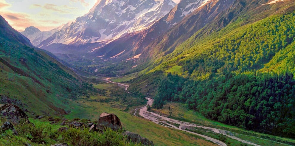
The Sar Pass Trek is a thrilling journey through the heart of the Himalayas, making it one of the best treks in India for summer explorers. Starting from the scenic village of Kasol in Himachal Pradesh, this trek ascends to an impressive altitude of 13,800 feet, offering breathtaking views of lush forests, vibrant meadows, and snow-clad peaks.
Highlights include hiking through pine and rhododendron groves, crossing shimmering ice fields, and camping in the enchanting Grahan Village, where the star-filled skies captivate every visitor. A paradise for nature lovers, photographers, and adventurers, Sar Pass is the ultimate escape to experience winter chills at the peak of summer.
As you climb, the landscape transforms dramatically from vibrant meadows to snow-capped peaks, with a variety of terrains including woodlands, grasslands, and snow patches. Ideal for beginners, the trek’s moderate difficulty makes it an accessible adventure for anyone eager to explore the majestic Himalayas. Whether you’re seeking adventure, peace, or the beauty of nature, the Sar Pass Trek offers an unparalleled experience that will stay with you forever.

Highlights of the Sar Pass Trek
- Spectacular Scenic Views: The Sar Pass Trek treats trekkers to mesmerizing vistas of snow-capped peaks, lush valleys, winding rivers, and dense forests. Experience panoramic views of the majestic Himalayan ranges, including the iconic peaks of Parvati Valley.
- Summit the Majestic Sar Pass: The trek reaches its peak at an altitude of 13,800 feet (4,200 meters), where you’re rewarded with awe-inspiring 360-degree views of the surrounding Himalayan peaks, including Tosh Glacier, Min Thach, and Nagaru.
- Camping Under the Stars: Set up camp in pristine meadows like Grahan, Min Thach, and Nagaru, where you’ll spend the night surrounded by nature’s beauty. Sleeping under a sky full of stars in the heart of the Himalayas is an experience that will stay with you forever.
- Thrilling Adventures: Thrill-seekers will love the adventure-filled activities on the trek, including snow trekking, rock climbing, rappelling, and river crossing. These exciting challenges add an extra layer of excitement to the journey.
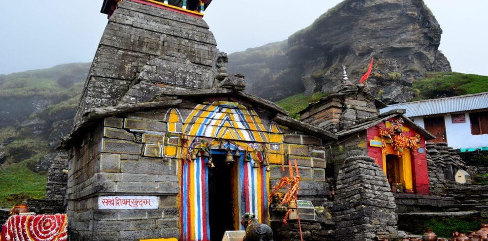
- Cultural Exploration: Trek through remote Himalayan villages like Kasol, Grahan, and Tosh, where you can interact with the locals and experience the rich culture, traditions, and way of life of these secluded mountain communities.
What Can You Expect at The Trek?
The Sar Pass Trek is a wonderful adventure suitable for trekkers of all levels, including families. This trek is classified as easy to moderate, with daily distances of 7 to 9 km, taking approximately 7 hours each day to complete. The trail offers a manageable yet thrilling challenge, making it an excellent choice for first-time trekkers or those looking to experience the Himalayas at a comfortable pace.
As you ascend to higher altitudes, expect a wide range of temperatures. Daytime temperatures can reach a pleasant 22°C, while nighttime temperatures can plummet to -5°C. The high-altitude conditions can bring sharp shifts in weather, so it’s essential to pack in layers and follow your guide’s recommendations to ensure comfort and safety throughout the journey.

The optimal time to embark on the Sar Pass Trek is between May and October, when the weather is generally clear, offering unbeatable views of the surrounding mountain ranges. Along the way, you will not only witness breathtaking landscapes but also experience the hospitality of local villagers, who call the remote Himalayan villages home. These interactions provide a fascinating insight into the traditional lifestyle and culture of the region.
The trek is a true immersion into nature, offering a chance to discover the rich biodiversity of the area. As you make your way through varying terrains, you’ll encounter forests filled with pine, deodar, spruce, and Fir trees. You’ll also find medicinal plants like Brahma Kamal and Hatha Panja. Keep an eye out for wildlife, including the Himalayan Tahr, Brown Bears, and rare bird species like the Monal pheasant and Western Tragopan.
For those seeking a mix of adventure, natural beauty, and cultural exploration, the Sar Pass Trek offers an unforgettable experience. Whether you’re after a thrilling challenge or simply want to immerse yourself in the pristine landscapes of the Himalayas, this trek delivers everything you need for an extraordinary journey.

How to Reach Kasol
All participants must arrive at Kasol by 11:00 am on the trek’s start date. Once at the assembly point, Get Set Trek will manage further travel arrangements for those who opt for the pickup service. This service can be added during booking.

Travel Options to Kasol:
By Bus:
From Chandigarh: 10 hours (overnight).
From Delhi: 14 hours (overnight).
Government buses are more reliable than private operators. Ensure you arrive in Kasol by 9:00 am for a timely start.
Via Kullu:
Take an overnight bus to Kullu, then a private taxi or shuttle bus to Kasol.
By Flight:
Fly to Bhuntar Airport (2 hours from Kasol). However, flights to Bhuntar are costly and prone to cancellations. If flying, arrive a day before the trek starts.
By Train:
Travel to Pathankot Railway Station (300 km from Kasol). From there, take an overnight bus to Kullu/Kasol. Arrive a day in advance for convenience.
Recommended Option:
Fly to Chandigarh Airport and take a bus to Kasol for a balanced and reliable journey.
Drop-off Information:
Participants will be dropped back at Kasol between 4:00 pm and 6:00 pm on the final day.
Trek Name: Sar Pass Trek Location: Himachal Pradesh
Adventure Type: Trekking
Grade: Moderate
Duration: 5D/ 4N
Altitude: 13800 Ft.
Base Camp: Kasol
Stay: Camping (Twin sharing) & Home Stay (Separate for male & Female)
Food: Meals while on trek & at Hotel/Guesthouse (Veg & Eggs)
Season: Summer
Month: April | May | June Distance: 50 Km.
Trail Type: Cross over trail | Start in one valley, traverse the pass, and ends in another valley.
AirPort: Bhuntar, which is 52 km away from Manali
Trek Essentials
Bags
- Backpack (40-60 L): Sturdy with a supporting frame and a rain cover (mandatory).
- Daypack (20 L): Mandatory for those offloading backpacks. Not required if carrying your own backpack.
Footwear
- Trekking Shoes: No sports shoe. opt for sturdy shoes with good grip and ankle support (e.g., FORCLAZ 100, 500, 600). Break them in a week before the trek to prevent blisters.
- Socks (3 pairs): 2 cotton, 2 woollen (for campsite and sleeping).
Clothing
- Trek Pants (3 pairs): Lightweight, quick-dry pants recommended. Avoid denim, shorts, or 3/4 pants.
- Collared T-Shirts (3 pairs): Light, full sleeve to prevent sunburn. Avoid bright colours.
- Full Sleeve Woolens (2 pairs): Fleece preferred over wool for its warmth and lightness.
- Thick Jacket: Windproof or down jacket.
- Thermal Inners: Lightweight upper and lower (optional).
Accessories
- Rain Protection: Lightweight poncho (preferred) or raincoat.
- Balaclava/Scarf: For ear and neck coverage.
- Gloves: Waterproof gloves (synthetic) and warm fleece/woolen gloves.
- Sun cap: For sun protection.
- Sunglasses: UV-blocking; no blue or multi-tone lenses. Essential for snow. If using spectacles, opt for photochromatic lenses or large sunglasses that fit over them.
- Trekking Pole: Mandatory.
Other Essentials
- Toiletries: Sunscreen (SPF 40+), lip balm, moisturizer, toilet paper, wet wipes, soap, and towel.
- Cutlery: Plate, spoon, mug, and lunch box (for hygiene).
- Water Bottles: Two 1-liter bottles (disposable bottles not allowed).
- Headlamp/Torch: Mandatory (with spare batteries).
- Plastic Covers: For compartmentalizing items and wet clothes.
Medical Kit (Mandatory)
- Medicines: Diamox, Crocin, Avo mine, Avil 25mg , Combi flam , Disprin (6
- First Aid: Crepe bandage, gauze, Band-Aids (10), cotton roll, antiseptic cream (e.g., Betadine), ORS (10), Moov spray.
Mandatory Documents
- Original and photocopy of government photo ID (e.g., driving license, voter ID).
Tips
Always carry personal cutlery for hygiene.
Avoid sports shoes; trekking shoes are essential.
Layer with lightweight clothing (fleece preferred) rather than bulky jackets.
Use synthetic quick-dry trek pants and collared T-shirts for comfort and protection.
Ensure all gear is weather-appropriate and reliable for high-altitude conditions.
Day 1: Kasol to Grahan village
Day 1: Kasol to Grahan village
Drive Distance: 10 km | Duration: 4-5 hours | Altitude: 1,700 m. Grahan – 2,350 m. | Reporting Time: 11:00 a.m. | Drop Time: 6:30 pm to 7:30 pm (Timings are subject to change based on weather and road conditions). Please reach Kasol a day before to avoid any delays.
Transportation Amount is not included in the trek cost.
The trek from Kasol to Grahan is a well-marked trail that follows the scenic Grahan Nalah, starting from the heart of Kasol. The path, frequently used by villagers, maintains a gentle gradient, allowing trekkers to cover significant distances effortlessly within hours.

Initially, the trail stays on the true left of the nalah, crossing it midway before ascending into rocky terrain. Though the steep climb away from the riverbank may seem misleading, staying on course is essential.
As the forest gives way to grasslands and shrubs, trekkers will encounter fields and vibrant makeshift stalls offering refreshments such as tea, omelettes, and the locally famed rhododendron syrup. The syrup, made from the bright red rhododendron flowers (locally called burans), is a delightful energy booster when mixed with water. These flowers, harvested from forests that experience snowfall, bloom in spring and are cherished for their tangy flavour and revitalizing properties.
A final steep ascent of about an hour leads to Grahan village, perched atop a hill. Overnight stays can be arranged at guesthouses, or the campsite located beyond the village. The village is equipped with a satellite phone, and sporadic mobile network coverage is available.
Experience the charm of Grahan—a serene retreat amidst nature’s splendour.

Day 2: Grahan to Min Thach
Day 2: Grahan to Min Thach Immersing in Spirituality and Nature
Drive Distance: 7 km | Duration: 4-5 hours | Altitude: 2,350 m to 3,400 m
The trail from Grahan to Min Thach begins from the campsite and gently ascends northward. Frequently used by villagers in the early hours, the route gradually unveils panoramic views, with prominent landmarks like Min Thach, Nagaru, and Sar Top visible to the right.
The trail steepens as it winds through dense forests, where sunlight barely penetrates the thick canopy. Certain sections of the path can be confusing, so attention and guidance are advisable. After a challenging ascent, the forest opens to a grassy ridge—Min Thach, a meadow where locals graze their cattle.
From this ridge, the breathtaking Chanderkhani and surrounding ranges stretch across the north-west horizon. To the east, the ridge rises to a snow-covered cliff, home to the Nagaru campsite. To the south-east lies an expanse of forests.
Min Thach offers cleared spaces for camping, with a nearby potable water tap and occasional vendor huts selling tea, coffee, and omelettes. The ridge provides protection from strong winds, though it’s recommended to dig trenches around tents for natural water drainage during rain or snowfall.
Taking a full day for this stretch allows time to acclimatize and prepare for the trek ahead. Experienced trekkers may opt for a faster pace, starting early from Kasol, breaking at Grahan for lunch, and reaching Min Thach by late afternoon.

Day 3: Min Thach to Nagaru
Day 3: Min Thach to Nagaru
Drive Distance: 8 km | Duration: 4-6 hours | Altitude: 3,400 m to 3,800 m
The trek from Min Thach to Nagaru, though seemingly short, follows a circuitous route that veers south into the woods rather than ascending directly along the ridge. Snow may be encountered, making it essential to start early, as the weather is typically more favourable, and snow less slippery, before noon.
The trail leads to a rocky ridge overlooking grassy meadows below. It then ascends steeply eastward towards the cliffs where the Nagaru campsite is situated. Beyond the tree line, the path transitions to grass and shrubs, though snow can obscure it, increasing the challenge. This section is the most technical and hazardous part of the trek, with a steep drop to the valley below. Caution is imperative, and the assistance of a guide, trekking pole, and waterproof gloves is highly recommended. Guides may also use ice axes to carve footholds in the snow, and trekkers should employ precise techniques to ensure secure footing.
After a strenuous climb, the Nagaru campsite emerges—a flat expanse atop the ridge. The views are spectacular: to the north, the towering mountains of the Parvati Valley; to the northwest, the Chanderkhani and Beas ranges; and below, the Min Thach campsite and Grahan village. To the south stretches a vast snow-covered slope leading towards Sar Pass, though the pass remains out of sight.
Network coverage is intermittent, and while a water tap is available near the western edge, it is often dry, so carry water from Min Thach. Establish camp quickly, as the winds are fierce, and temperatures plummet rapidly post-sunset.
Nights at Nagaru are extremely cold, with the wind chill factor being significant. Strong winds can sometimes dislodge tents, so secure them firmly. It is advisable to retire early to conserve energy and prepare for the next day’s early start toward Sar Pass.

Day 4: Nagaru – Sar Pass – Biskeri Thach
Day 4: Nagaru – Sar Pass – Biskeri Thach
Drive Distance: 14 km | Duration: 6-8 hours | Altitude: 3,800 m – 4,200 m – 3,350 m
An early start is essential for the trek from Nagaru to Sar Pass and onward to Biskeri Thach. The day begins with a steep climb along the ridgeline southward. The ascent, though challenging, is made easier by acclimatization from the previous day, and the pristine snow-covered landscape keeps morale high.
After climbing the first ridge, a higher hill comes into view, marking a third of the journey to Sar Pass. The terrain becomes sharper and steeper, requiring cautious footing, especially in snow. Guides, ice axes, and trekking poles are invaluable for navigating this section. The climb feels arduous but culminates in an awe-inspiring moment as the panorama of Sar Pass unfolds—a dazzling expanse of snow framed by the towering peaks of the Tosh Valley to the east.
The trek continues southeast, descending along the contours of the hill. The trail then ascends a ridge marked by a Trishul flag, the final climb to Sar Pass. A steep, snow-covered slope with ropes for support leads to the top. From here, the descent begins with an exhilarating slide—a thrilling and safe experience when precautions are taken. The slide can extend over a kilometer, delivering trekkers to gentler slopes. Additional slides follow, passing through snowy valleys and unveiling the serene meadow of Biskeri Thach.
Biskeri offers a sublime campsite surrounded by pine forests, snow-dusted peaks, and verdant grasslands. The villages of Tosh, Pulga, Tulga, Bursheni, and Nakthan are visible in the valley below. The meadow of Bun-Buni is perched on a ridge to the northeast. A nearby waterfall and a flowing stream provide ample water supply. Network coverage is intermittent but available.
Biskeri Thach is a perfect place to rest and revel in the beauty of nature after an adventurous day.

Day 5: Biskeri Thach to Bursheni and Drive Back to Kasol
Day 5: Biskeri Thach to Bursheni and Drive Back to Kasol
Altitude: 3,350 m to 2,400 m | Drive Distance: 10 km | Duration: 4-5 hours
The descent from Biskeri begins with a steep path along the left of a stream. After crossing the stream, the trail briefly disappears near a fenced plot of land. Look for a gap in the fence to continue on the trail, which leads into a dense forest. Here, multiple trails converge, and a guide is essential to navigate the correct northeast-bound path.
After a prolonged descent through the forest, the trek reaches a stream crossing near a campsite. Accessing this point involves rappelling down a 20-foot rock face using ropes. Cross the stream via wooden planks, and ascend to the campsite, which hosts vendor tents. The trail to Pulga begins to the left of this site.

The path soon opens to a picturesque grassland surrounded by trees—one of the most scenic spots on the trek. It then continues through a dry channel into the woods, with the descent becoming steep. After passing through a clearing and a fenced property, the trail leads to a forest department lumber yard. Following a water pipeline, the trek concludes at Pulga village.
Pulga and Tulga villages are separated by a stream. From Tulga, cross a bridge over the Parvati River to reach Bursheni, the road head of the Parvati Valley. Bursheni serves as the starting point for treks to Kheerganga, Mantalai Lake, Pin Parvati Pass, and Tosh Valley. Buses and taxis to Kasol, Bhuntar, and other destinations are readily available here.
This trek concludes with unforgettable memories of breathtaking landscapes, thrilling adventures, and serene mountain charm.

Includes/ Excludes
Includes
- Pick and Drop Transfers from/to Kasol
- All meals are included with proper hygiene parameters.
- Triple/double sharing tent accommodations are available.
- Kasol guest house with double, triple, or quad occupancy.
- During the trek, there will be morning and evening tea with a small refreshment.
- All tolls and forest fees.
- Trekking gears (tents, sleeping bags, ropes, gaiters, crampons etc.)
- First Aid Medical Kit.
- Expert Guide
Excludes
- Food during pick and drop transfers
- Porters/mules charges
- Personal expenses
- Any optional activities expense.
- Insurance
- Anything apart from the inclusions
- 5% GST extra